Merano 2000 | Merano and surroundings

How to reach Merano 2000

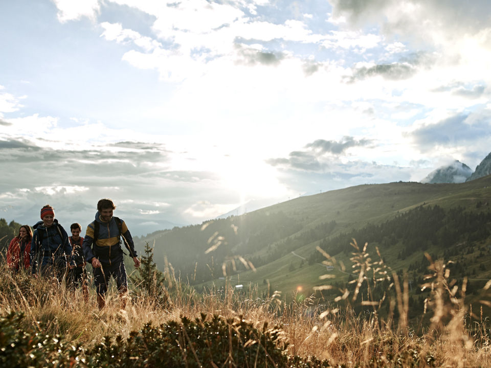
On the sunny mountain plateau of Avelengo/Hafling, Verano/Vöran and Merano 2000, located above the spa town of Merano/meran, hikers can find numerous attractive routes and varied trails. Easy hiking trails lead through larch forests and mountain meadows, past ancient churches and alpine lakes. Many routes are suitable for families with strollers. On the other hand, experienced hikers will find challenging summit tours higher on the Ifinger mountain.

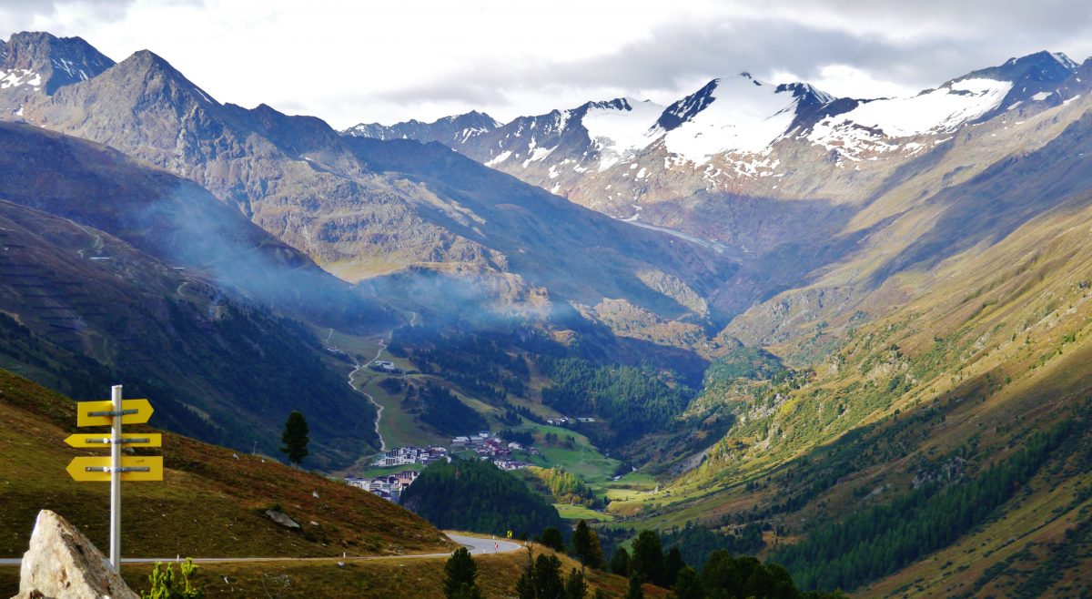
Upon arrival in Merano 2000 the breathtaking view stretches as far as the Ortles mountain range and the Dolomites UNESCO World Heritage site. More romantic souls can take an excursion with Haflinger horses from Avelengo and Verano, while others can enjoy mountain biking routes, hiking trails and excursions to mountain peaks.

In summer the Outdoor Kids Camp becomes a playground with a small petting zoo. While kids enjoy the nature and outdoor activities, the parents can have a rest on the terrace of the Panorama Bistro… without losing sight of their children. Adrenaline junkies can get their fix on the Alpin Bob, a 1.1 km rail-guided bobsled run.

Village Museum | Aldein

How to reach the Village Museum at Aldein

The Village Museum contains religious art as a symbol of the piety and art forms of the Baroque and Rococo periods. A special jewel is the treasure of the Thalhof. There are also paintings, woodcarvings, coins and medals from private collections.


Please check this website for detailed information on opening hours and prices.

df

Contact:
Dorfmuseum Aldein
Dorfplatz 41
39040, Aldein
+39 338 1085870

Pass Museum | Timmelsjoch

How to reach the Pass Museum

The new Pass Museum on the North Tyrolean side juts out like an erratic boulder into the South Tyrolean side, underlining the cross-border nature of the Timmelsjoch Experience. The “Ice Cave” inside the museum pays tribute to the pioneers of the High Alpine Road and their remarkable accomplishment.

Discover all about…

  • the history of the Timmelsjoch High Alpine Road.
  • the name Timmelsjoch.
  • a brooch dating back to the pre-Christian era.

Please check this website for detailed information on opening hours.

df

Contact:
Tourist information Val Passiria
Via Passiria 40
39015 S. Leonardo in Passiria
+39 0473 656188

Mount Plose | Isarco Valley

How to reach the Plose

On the Plose you can fully enjoy your summer holidays. It does not matter if you stay for a day or a whole week. Plose offers you a whole range of possibilities to spend your holidays in South Tyrol.
Indeed, in summer Plose is the favorite destination for all families looking for adventure and entertainment, for those who love hiking on easy and challenging trails, and for those who want to enjoy a few relaxing hours, or decide to take a trip on a mountain bike. Our guests love the hiking trails, especially WoodyWalk, our family trail full of attractions. They are enthusiastic about the mountaincarts, kind of gocarts that allow you to run downhill for 9 km until you reach the bottom station of the gondola lift again.Last but not least on the Plose a number of caches are hidden for friends of geocaching.
The breathtaking 360 degree view from Plose is also known outside Southtyrol. The view extends from the Stubai Alps to the Dolomites and the Ortles. Many consider it the most beautiful view of the Dolomites, directly on the outskirts of Brixen. Outstanding also the view of the old episcopal city of Brixen in the middle of the Isarco Valley, that borders the High Isarco valley and the High Pusteria Valley.
Brixen Plose – summer and winter a mountain full of entertainments, for a summer holidays on its best.

Stone cairns | Bolzano and surroundings

How to reach the Stone cairns

The cairns are a special place, a real place of energy in Meltina and one of the most beautiful viewpoints in the Sarntal Alps: From here you can look over the whole of the Dolomites world up to Marmolada and Monte Ortles.
On your holidays in Meltina you should not miss out on a hike to these over 100 stone cairns. These pillars made from sandstone rocks await you like a troop of soldiers.
Their history and meaning is not clear. Were the cairns once used as signposts? Did herders build them here to while away the time? Do they point to meetings of witches or to some Celtic cult? Rock carvings and flint stone equipment point to the Stone Age and to the Middle Ages. A court document from 1540 confirms this origin, and that some 500 years ago the site was a place of witches dances and satanic ceremonies. Scary stories of how the witches made thunder and lightning and eating children are included! Ancient engravings even point to this viewpoint having been a Celtic worship site many centuries ago.

ar/ge Kunst | Bolzano

How to reach the ar/ge Kunst

The ar/ge is the art association of Bozen/Bolzano, a non-profit institution that annually presents and sponsors four exhibitions of regional and international artists working in contemporary art, architecture and new media. Every exhibition is related to several events (artist talks, lectures, performances).


Please check this website for detailed information on opening hours and prices.

df

Contact:
ar/ge Kunst
Museumstraße 29
39100, Bozen
+39 0471 971601

Seceda | Gardena Valley

How to reach Seceda

The Seceda area is located on the sunny side of Val Gardena, at the foot of the Natural Park Puez –Odle.
From the Seceda summit you can enjoy a wonderful view of the Dolomites and of all the mountains in South Tyrol.
Our area offers a great number of mountain huts and refuges where you can stop, refresh yourself and have a nice time.
Every single hut on Seceda has its very special charm and boasts a really distinctive atmosphere. An original wooden bench, a comfortable deck chair, a sunbathing terrace or a cosy “stube” – Seceda offers something for everyone. Skiers, snowboarders, hikers, paragliders but also families with children … everybody meets on Seceda!


df

Contact:
Dolomites Val Gardena
+39 0471 777777

Montiggl forest | Appiano

How to reach Montiggl forest

Position:
The nature reserve Montiggl forest is located on the Mitterberg and offers a lot of space for all kinds of activities. The mixed forest with an area of 100 hectares and the Big and Small Montiggl Lake is rated as South Tyrol biggest local recreation area.

Trivia:
If you are walking, horseback riding, with a bicycle, mountain bike or on a blanket next to the lake – it is the combination of relax and active holidays which make the Montiggl lake a unique spot.
The castle, wine and culture community Eppan on the Wine Street pursue the goal of sustainable, responsible forest cultivation and a controlled further processing of the nature product wood. The community of Eppan is one of the biggest forest communities in South Tyrol and after the implementation of different sanctions the community of Eppan got awarded the internationally recognised certification PEFC.

Walking and Mountain bike tours:
Well-maintained walking trails stretch through the forest, in which is located the Spring Valley with its snowdrops and daffodils. The Montiggl Forest is popular not only among hikers but as well among Mountain biker, who find flowy single trails. Not exposed, fluent to ride, some ascending slopes and technical sections – that is why biking is so much fun. In the summertime a jump into the Montiggl Lake make the whole day just perfect.

Geoparc Bletterbach Gorge | Bassa Atesina

How to reach the Bletterbach gorge

A journey through millions of years…

… is that along your hiking tour through the Bletterbach gorge. This UNESCO World Heritage site provides insight into the inner part of the mountains, into the world of rocks and stones and into the structure of the Dolomites. The gorge is an open book, where scientists, hikers passionate about geology, as well as nature-loving families with children may read about more than 40 million years of geological history.

The Bletterbach gorge is the result of weathering and erosion: since the last ice age 18,000 years ago, constant forces of water, wind and weather have been shaping the gorge wiping away more than ten billion tons of rock material into the Val d’Adige-Etschtal valley. This is how the little and inconspicuous stream has been carving its way on a 8 km (4,9 miles) long and about up to 400 m (1,312 ft) deep stretch into the rocks across different geological areas. Unlike the obscure conditions in other areas of the Alps, rock layers are here intact and visible, exactly as they were deposited millions of years ago. The rock structure provides relevant information about the creation process as well as about climate and weather conditions in our world of about 280-240 million years ago.

Price:

Adults Children up to 14 years
Entry 6,00 € frei
Guided tour 14,00 € 12,00 €
Themed hiking tours 24,00 € 16,00 €

Opening hours:
April 28 – October 31
daily: 9.30am – 6pm

Contact:
GEOPARC Bletterbach gorge
Lerch 40, 39040 Aldino
Tel.: +39 0471-886 946