Fanes-Senes-Braies Nature Park | Pusteria Valley

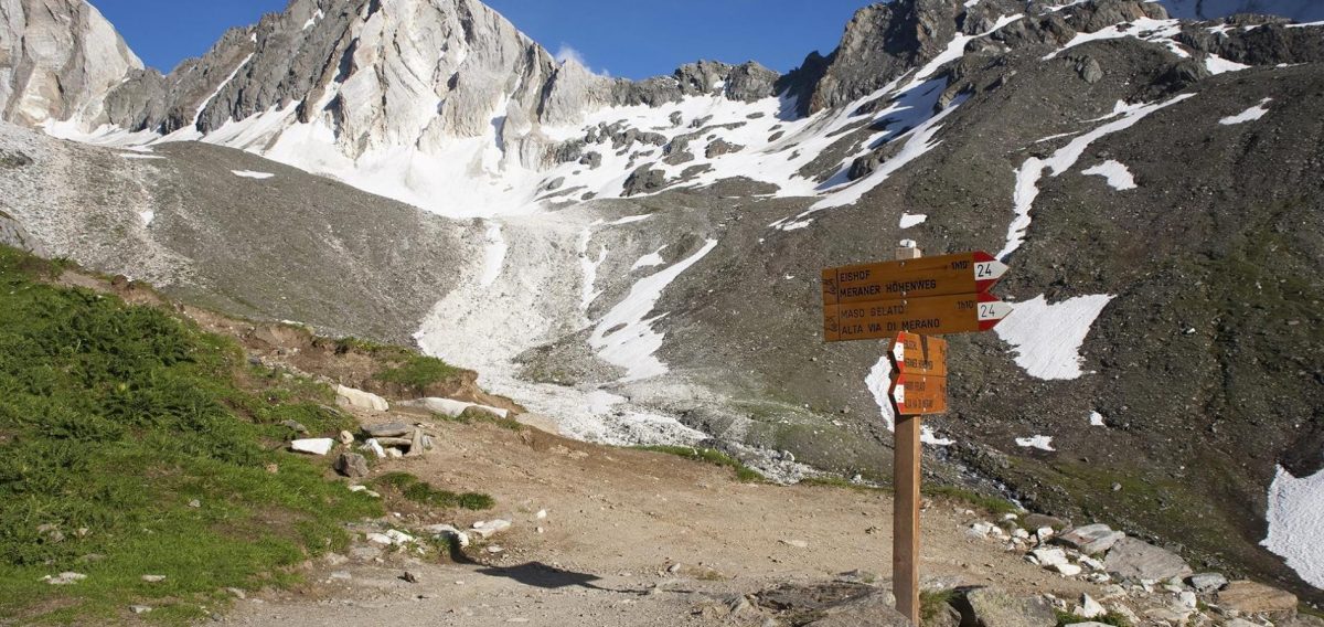
How to reach the Fanes-Senes-Braies Nature Park

The Fanes-Senes-Braies Nature Park covers an area of 25,397 hectares and stretches from the Valle di Braies valley with Lake Braies to Dobbiaco and throughout the Alta Badia.

This reserve is one of the biggest protected areas in South Tyrol and covers the municipalities of Badia, Marebbe, La Val, Valdaora, Dobbiaco and Braies. As the name of the Fanes-Senes-Braies Nature Park – “Naturpark Fanes-Sennes-Prags” in German, “Parco Naturale Fanes-Senes-Braies” in Italian – suggests, on its surface of 25,453 hectares it includes the area of the Braies Dolomites, the Senes Highland and big part of the Fanes Group.

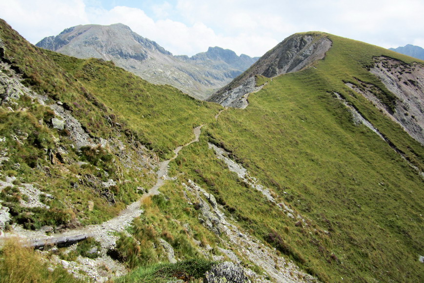
There are also four interpretive nature trails. The Larch Trail connecting the Rüdeferia and Rü farms above San Cassiano in the Val Badia valley forms the border of the nature park. Main topics of the 1 km long trail are the different landscape types such as the larch meadows and forests.

The Lake Dobbiaco Trail, however, takes along the shore of the eponymous lake in the upper Val Pusteria valley and offers 11 interactive stations. It is located exactly on the border with the Three Peaks Nature Park. Furthermore, you can explore the “Maite Fountains” nature trail as well as the “Tru dal’ega” theme Path (Water Trail) near the visitor centre in San Vigilio di Marebbe (St. Vigil).

Opening hours:
Open all year


df

Contact:
Naturparkhaus Fanes-Sennes-Prags
Katharina Lanz Str. 96
39030 St. Vigil in Enneberg
+39 0474 506120

The Odle | Funes Valley

How to reach the Odle/Geisler

The mountain massif Odle/Geisler is located between the Val di Funes/Funes Valley and the Val Gardena, in the heart of the Puez-Odle Nature Park. The main peak of this mountain range is the Sass Rigais. The Forcella del Mezdì cuts the group into two parts, leaving it to the west the real group of Geisler, and eastern Sass Rigais and Fruchetta, both 3,025 metres.

The Odle/Geisler group is the emblem of Val di Funes. It is known as the most beautiful massif of the Dolomites, also because of the classic and rugged profile. Those, who have had the chance to admire the Alpenglow on a clear September day, will never forget such a great natural spectacle. Glowing peaks like gold tower above the dark forests, and only until the sun sets and the massif turns pale.

Opening hours:
Open all year


Tessa Group Nature Park | Venosta Valley

How to reach the Gruppo di Tessa Nature Park

Texelgruppe / Gruppo di Tessa Nature Park Visitor Center opened in 1984 in the middle school in Naturns / Naturno and assumed its current form in 1992. The facility’s motto, Water and Light, reflects the diversity and interdependence of the park’s habitats. .

Water is one of the center’s leitmotifs, which is embodied by a replica of a spring biotope, an exhibit concerning the intriguing Waale irrigation technique, and a pond biotope.

The microscopes at Texelgruppe / Gruppo di Tessa Nature Park Visitor Center houseenable visitors to discover that “lowly” lichen or micro-organisms are veritable works of art of Mother Nature. In the reading area, visitors can classify plants and insects that they have brought with them, to which end the staff is happy to supply magnifying glasses and other instruments.

Large wall projections display the variety of interdependent habitats found in Texelgruppe / Gruppo di Tessa Nature Park, along with its characteristic flora and fauna. A relief and a trail map (scale 1:25,000) help visitors to orient themselves in this, South Tyrol’s largest nature park. On the upper level of the facility, visitors can test their senses with smelling sachets and tactile boxes. On a monitor, 20 registered bird sounds can be assigned to the different birds living in the nature park. The life-like taxidermy animals exhibited in natural imitations of their Alpine habitats, which range from mountain forests to glacier regions, are also an impressive attraction. Multi-screen elements guide the visitor through the diversity of all of South Tyrol’s nature parks and provide information concerning nature and landscape conservation in the region.

Opening hours: 
9th April- 12th October:
Tuesday – Saturday: 9.30am – 12.30pm & 2.30pm – 6pm
Open also on Sundays in July, August and September.

Price:
Free entry

Contact: 
Gruppo di Tessa Nature Park
Feldgasse 3
39025 Naturno
+39 0473 668201

Sarentino Alps | Bolzano and surroundings

How to reach the Sarentino Alps

Like a horseshoe, the mountain chain of the Sarentino Alps surrounds the Val Sarentino valley in the heart of South Tyrol – it can be explored on the Horseshoe High Route within seven days.

Really high mountains can only be found in the northern part, an area which nearly resembles a high mountain region. Towards south the mountains of the Sarentino Alps bottom out and form large plateaus, like the Monte Zoccolo in the west, the Villandro Alp in the east and the Renon High Plateau in the south, characterised by the famous Mt. Corno del Renon. The highest mountains are Mt. Corno Bianco (2,705 m a.s.l.), Mt. Corno di Tramin (2,708 m a.s.l.), Mt. Cima di San Cassiano and Mt. Grande Ivigna (both 2,581 m a.s.l.).

The boundaries of the Sarentino Alps are the Adige and Isarco rivers, the Val Passiria valley near Merano and the Passo Giovo mountain pass. The street leading from Vipiteno to Bolzano via the Passo di Pennes mountain pass, however, devides the Sarentino Alps into an eastern and a western part. Worth mentioning are particularly two highlights: the Earth Pyramids on the Renon as well as the Holy Cross Pilgrimage Church of Lazfons, situated at notable 2,311 m a.s.l. and therefore one of the highest located pilgrimage sites of South Tyrol.

With 40,000 hectares, the Sarentino Alps would be the largest nature park in South Tyrol, which might include the localities of Sarentino, Renon, Avelengo, Verano, Meltina, San Genesio, Racines, Campo di Trens, Fortezza, Varna, Bressanone, Velturno, Chiusa, Villandro and Barbiano. All requirements have already been fulfilled – a protected area has been planned.

Highest peak: Punta Cervina (2,781 m a.s.l.)
Major mountains: Mt. Corno Bianco, Mt. Corno di Tramin, Mt. Corno del Renon, Mt. Cima di San Cassiano, Mt. Pascolo, Mt. Picco Ivigna
Area: South Tyrol (Italy)