How to reach Aurino Floodplain Forest Biotope
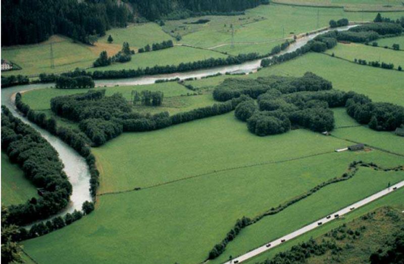
A natural treasure can be found in the Val Pusteria valley, on the left bank of the Aurino river, the most important inflow of the Rienza river. Near the villages of San Giorgio and Stegona, the edge of the Aurino Floodplain Forest lies – “Biotop Ahrauen” in German, “Ontaneti dell’Aurino” in Italian -, a protected area which covers a surface of 60 hectares and includes the municipalities of Brunico, Gais, and Campo Tures. Strictly speaking, it is the area of the lower Aurino River between Molino di Tures and Brunico which has been revitalized since 2003.
This pristine alluvial forest has a long history, dating back to the time of the Austro-Hungarian Empire. Nowadays, the area can be discovered on some hiking trails – one of them is the Aurino theme trail (Ahr Erlebnisweg). The path is suitable for prams until a viewing platform which offers a wonderful view of the surroundings. The Aurino Floodplain Forest is a habitat for many species of butterflies, fish, and birds such as the common kingfisher and the grey heron.
The Aurino Floodplain Forest, formed by glaciers in the last Ice Age, still shows how the primeval forest in this region once looked like. It has been placed under protection as a valuable biotope and a bird sanctuary, furthermore it is part of the European-wide Natura 2000 sites. By the way, the Pusterbike Cycle Path of the Valli di Tures and Aurina valleys leads from Brunico to Campo Tures, following partly the course of the Aurino river.