Lake Lagazuoi | Badia

How to reach the Lake Lagazuoi

The small Lago di Lagazuoi lake can be found at approx. 2,180 m a.s.l. in the protected area of the Fanes-Senes-Braies Nature Park. Geographically seen, it is located on the border to the province of Belluno, at about 1 km linear distance from San Cassiano and 500 m from the Rif. Scotoni mountain hut in Badia.

The mountain lake that is rich in fish is accessible along the Dolomite High Route no. 1 and on the trail proceeding from the Capanna Alpina mountain hut to the famous Mt. Lagazuoi. The striking rock face that towers above the lake is part of the 3,000 m high Cime Fanis peaks.

The name giving Mount Lagazuoi with its still preserved wartime tunnels was setting of the so-called Mountain Warfare during WWI and is nowadays a large outdoor museum and popular destination for hikers and mountaineers alike.

Gaul Canyon | Lana

How to reach the Gaul Canyon

A particular impressive and easy accessible testimony of natural forces is the Gaul Canyon (Gaulschlucht in German) at the entrance of the Val d’Ultimo. Rough rock faces composed of quartz-porphyry, gneiss and granite, dark caves, rope bridges and the rushing Valsura river make this walk an impressive adventure. Especially in summer it is genial cool here and the humidity gives rise to a little jungle.

From the Valsura bridge in Lana di Sopra, the Gaul Promenade proceeds into the wild valley along the river. The well-established hiking trail is secured by wooden bridges and is a contrast to the wilderness of the Gaul Canyon. The path leads to the Gaul Meadow beneath the castle hill of Braunsberg Castle. This location is the scenery of the Lana Open-Air-Theatre and other events, in autumn and winter however an ice skating ground can be found here. Either you take now the path past the electric power station through the narrow gorge until a waterfall (about 20 minutes) or you choose the way steep uphill, which leads near Braunsberg Castle and to the Val d’Ultimo road. From up there you have a gorgeous view on the canyon until the first houses of Lana.

Three artificial lakes in Val d’Ultimo impound the Valsura river that rises at the head of the valley and empties into the Adige river near Lana. So for safety reasons it’s not recommended to descent down to the riverbed, as the opening of water gates can cause a prompt rising of the water level!

Passer river | Merano

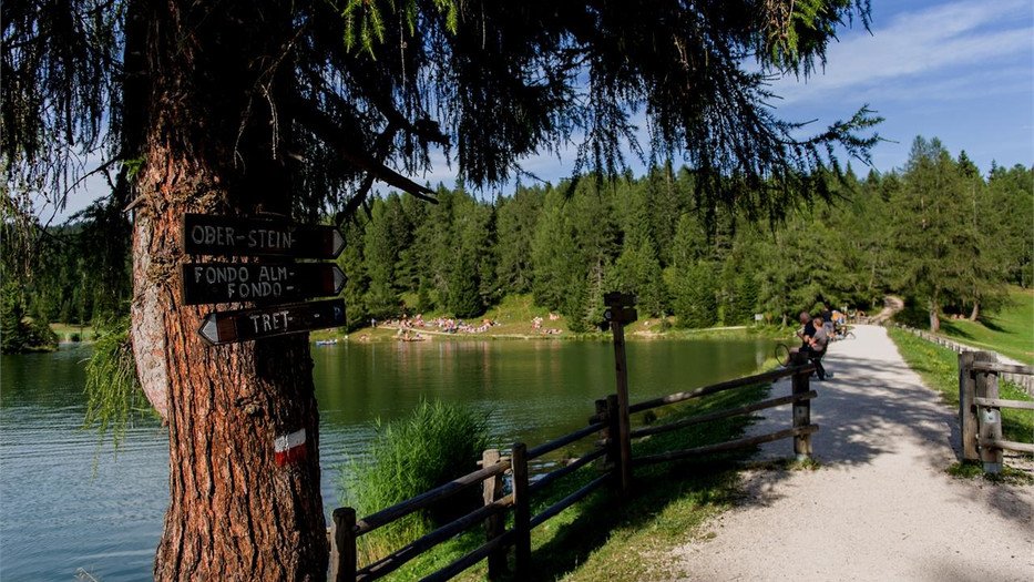
How to reach the Passer river

Find adventure and relaxation in the scenic gorges and along the green banks of the Passer river.

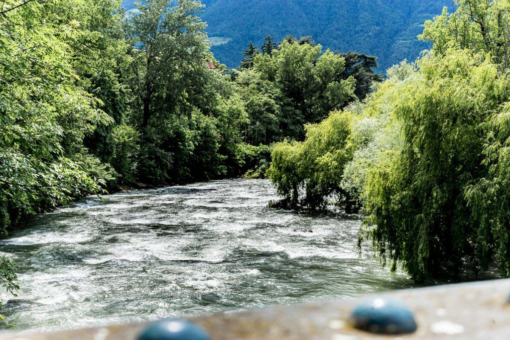
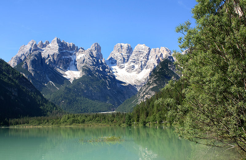
Some sections of the river are crystal clear and gentle. Others feature wildly thundering rapids pouring out of the valley. With a total length of 46.2 km, the river flows from the Timmelsjoch pass in the Passeiertal valley to Meran. Initially, the river starts out as a small mountain stream. But thanks to the countless tributaries that feed into the river along the way, it continues to grow, meandering through the spa town of Meran like a lifeline.

The Passer river divides Meran into two halves: the old town is situated on the right bank, while the residential quarter of Obermais/Maia Alta, boasting stately residences and noble houses, is located on the left-hand side.

The green Passerterrassen parks, popular local recreation areas, are easily accessible from the city center. Those on holiday in Meran in summer shouldn’t pass up the opportunity to relax by the river and cool their feet in the rushing waters. Visit in the early morning (when it is quiet and not yet too hot) and discover for yourself why the Passer is dubbed the “green lung” of Meran. Did you know that the Passer river is actually top-quality drinking water? According to biological indicators, the river’s water quality is class 1!

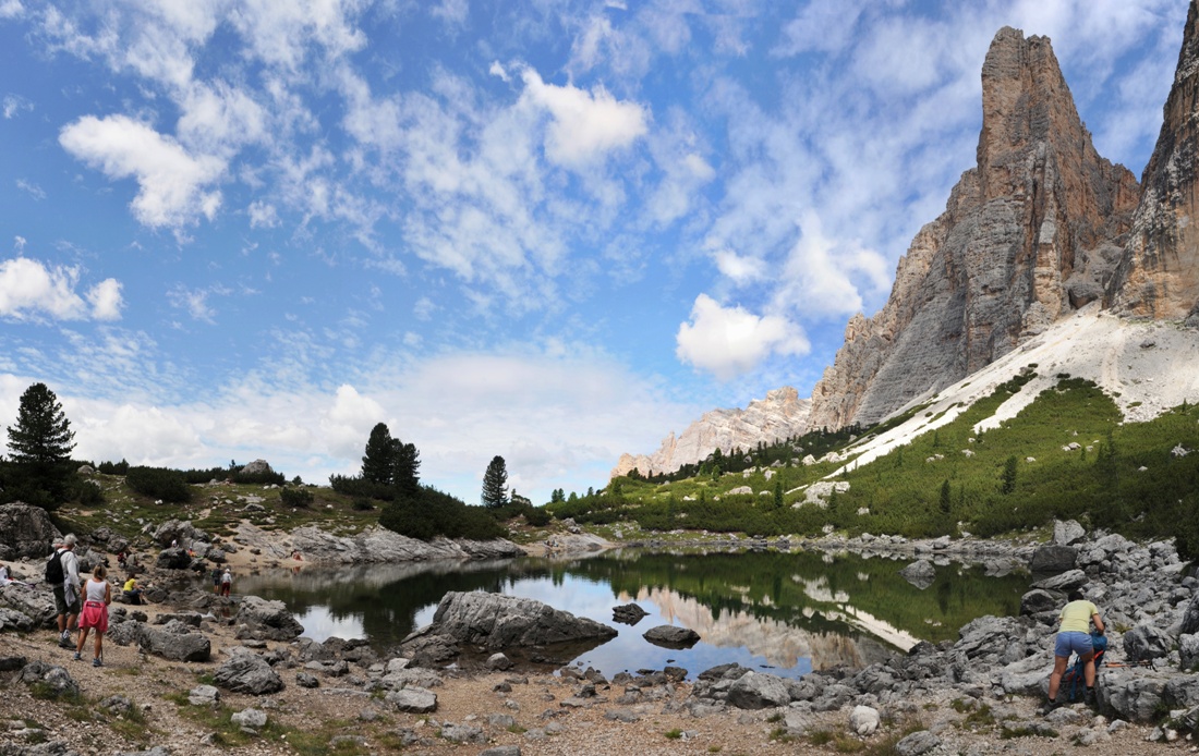
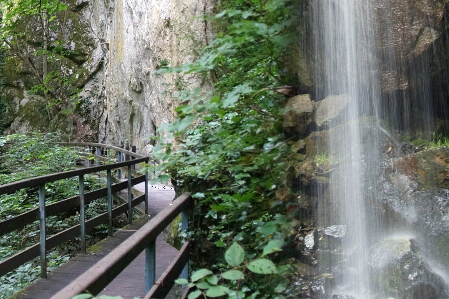
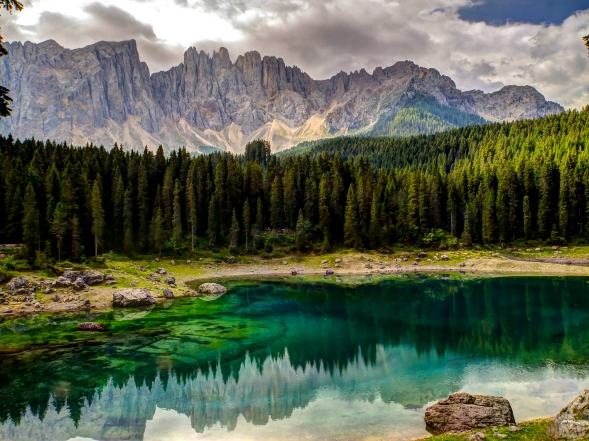
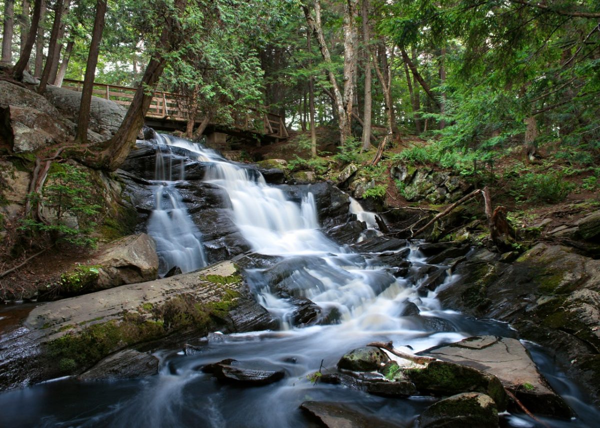
Back in the Passeiertal valley, the Passer river is young and wild. The Passer river’s fascinating gorges are the ideal places for Tarzaning and Canyoning. These fun sports transform rock faces into slides and waterfalls into whirlpools. With an experienced pro as your guide, experience the majesty of the Passer river up close and personal. Abseil, slide, swim, and dive as you test your limits and prove your courage.

Interesting side note: The Passeiertal valley hosts every year in June the so-called ‘King of the Alps’ – the European Championship in extreme kayaking.


Lake of Carezza | Carezza

How to reach the Lake of Carezza

Every vacationer in South Tyrol has to visit Lake Carezza, the most gorgeous Alpine mountain lake! This small mountain lake is well-known for its soft, deep green waters and the exquisite view of the Rosengarten and Latemar mountain ranges. The lake is at its most gorgeous in the evening or early morning, when the Rosengarten-Latemar mountain ranges and the green of the Karerwald forest are reflected in its crystal clear water. This is a natural spectacle you won’t want to miss! Numerous South Tyrolean legends surround the lake and many authors and painters choose these themes for their tales or paintings.

Important information:
– The lake lies at 1,520 metres in the municipality of Nova Levante and is 300 metres long and 130 metres wide.
– The lake is fed by underground springs from the Latemar mountain range.
– The depth and size of the lake is very seasonal and weather-related, the largest depth is given as 22 m.
– In winter it is also sometimes visited by divers who like to dive under a thick layer of ice and record the underwater play of colours in documentaries.
– The lake can be reached via the state road 241 (Eggentalerstaatsstraße – also called Dolomitenstraße).

San Felice lake | San Felice

How to reach Felixer Weiher Lake

Enjoyable hiking tour through the forests and alpine pastures of Alta Val di Non highly recommended over the late spring and early summer months because of the great variety of alpine flowers and in autumn due to its glowing larches. The hike starts at the parking area “Klammbrücke” just above the village of San Felice. From there the hiking trail no. 9 leads you directly to the San Felice lake (called also Felixer Weiher or Lago di Tret) in about 1 hour. The hike takes you through rough forests and mountain grassland whit panoramic views of the Val di Non and the Brenta Dolomites. The swimming lake (1604 m) has preserved itself as a natural biotope and has been rewarded for its excellent water quality. Not far from the lake there is the Felixer Alm – Malga di San Felice where you can rest end enjoy local dishes. The forest road from the Felixer Alm brings you back to the parking area. This hiking is also recommended for families with children.

Laghetto di Fiè | Fiè allo Sciliar

How to reach Laghetto di Fiè

The Laghetto di Fiè (germ.: Völser Weiher) Lake is classed as one of the cleanest swimming lakes in Italy: in 2017, Legambiente, the largest environmental association in Italy, awarded Italy’s best ecosystems with the ‘5 vele’. Among the 3 top exemplary lakes, we find the Laghetto di Fiè. Due to its intact ecosystem and outstanding water quality, the lake at the foot of the Sciliar is an extremely popular destination with swimmers. The Laghetto di Fiè is one of eight swimming lakes in the Dolomite region and is situated in the Sciliar-Catinaccio (germ.: Schlern-Rosengarten) Nature Reserve at the foot of the emblem mountain of the Dolomites: the Sciliar.

Opening hours:
all-season


df

Contact:
Laghetto di Fiè
Via Bolzano 4
39050 Fiè allo Sciliar
+39 0471 725047

Gilfenklamm gorge | Racines

How to reach the Gilfenklamm gorge

The Gilfenklamm is a gorge in pure white marble and stretches from the village Stanghe into the Val Racines to the hamlet of Ponte Giovo. Wooden bridges and runways lead through the canyon and give a spectacular sight to the waterfalls. The primordial power of the water is tangible with all senses. The gorge is protected as a natural monument and is known as one of the most beautiful natural attractions in the Alpine region.

The runways through the gorge were built in 1896 and just after a few years, the unfolded magic attracted numerous visitors. Between the great world wars, the bridges were left to decay, but were restored in the early 1960s, and have since become a must-see of the Vipiteno-Racines area. The hike through the gorge lasts nearly one hour (1,5 hours with return) and is worthwhile for nature lovers, families, and seniors.

df


Please check this website for detailed information on opening hours and prices.


df

Contact:
Tourist Office Racines
Via Giovo 1
39040 Racines
+39 0472 760608

Lago di Costalovara | Renon

How to reach Lago di Costalovara

Not far from Oberbozen/Soprabolzano lies the pond Wolfsgrubner See/Lago di Costalovara, fairytale-like amidst gentle, timbered hills, awaiting you with fun and relaxing activities all year round. During the summer, thanks to its excellent bathing water quality, the pond invites to splashing swimming adventures, while patient fishermen pull carp, pike, tench, and eel out of its waters. A laid-back walk around the pond promises peace and tranquility; breathing that crisp mountain air – definitely a natural way to relax! During the winter, things get a bit wilder on the pond as skaters glide across the ice. Because of its shallow depth and location at 1172 meters of altitude, the pond completely freezes over every year, and so witnesses blades blazing across its frozen surface every winter. It’s really easy to reach Lago di Costalovara Pond on foot from Soprabolzano along the promenade – a pleasant walk in summer as well as winter. For drivers, there’s a big free parking lot, and if you are riding the Railway Renon departing from Klobenstein/Collalbo or Soprabolzano, it stops in Wolfsgruben/Costalovara every half hour. From the station, it’s only a 5-10-minute-walk to the pond.


df

Contact:
Lago di Costalovara
Wolfsgruben
39054 Soprabolzano
+39 0471 356100

Lake di Landro | Dobbiaco

How to reach Lake di Landro

Surrounded by a fantastic mountain and summit scenario, Lake Lago di Landro lies in the inner Höhlenstein valley. This cool wetland is one of the three largest natural lakes in Alta Pusteria in South Tyrol and impresses not only with its spectacular colors but also with its ideal location.

Tourists can reach this turquoise lake from the south of Cortina as well as from the Pusteria Valley, where they can immediately enjoy the unique view of the Monte Cristallo on arrival. The trip already offers a stunning view of the Three Peaks, Monte Piano, or the Paternkofel.

df

Contact
Tourist Info Dobiacco
Via Dolomiti 3
39034 Dobbiaco
+39 0474 972132

San Valentino Lake | S. Valentino alla Muta

How to reach San Valentino Lake

Below the Passo Resia mountain pass, in the municipality of Curon Venosta, another well-known lake is located, Lake San Valentino Alla Muta. The main tributaries are the Rio Serres brook and the Adige river, drained from the neighboring Lake Resia.

Located at 1,450 m a.s.l., Lake San Valentino Alla Muta – “Haidersee” in German, “Lago di San Valentino Alla Muta” in Italian – is not really suited for swimming but a nice excursion destination all year round. A beautiful hiking and nordic walking route proceed around the lake, always with a view of “King Ortles” and the other partly glaciated mountains of the Ortles Alps. Also among bikers, the lake is very popular, as well as sailors and kitesurfers like it. Boating is allowed here, but only with an electromotor. In winter – the lake normally freezes up quite early – Lake San Valentino Alla Muta and neighboring Lake Resia are attractions for iceboat runners and snow kiters.

The hike around the lake (about 2 hours) starts already in Malles and proceeds to the lake biotope with ducks and coots. Then the route runs along the asphalted cycle path further towards Resia and through a forest area to the village of San Valentino Alla Muta. Here the signposts “Uferweg” (Shore Path) mark the way back towards Malles, this time on the left side of the lake.