Museum of the “Kastelruther Spatzen” | Castelrotto

How to reach the Museum of the “Kastelruther Spatzen”

In Castelrotto , you can find the Spatzen-Laden, the shop of the local music group “Kastelruther Spatzen”. In this basement are hidden all awards of “Kastelruther Spatzen” in a unique museum.

Opening hours:
Monday-Tuesday: 09:00 – 12:00 and 14:00 – 18:00
Saturday: 09:00 – 12:00

Price:

Ticket 2,00€

f
Note: For purchases over 5,00€ the 2 Euro will be refunded.

Contact:
Kastelruther Spatzen Museum
Dolomitenstraße 21
39040 Castelrotto
+39 0471 707439

Barbiano

How to reach Barbiano

From the valley bottom and from the banks of the Isarco (480 m), the sloping countryside becomes steeper and steeper until reaching Corno di Renon/Ritten (2260 m). Various vacation spots emerge among vineyards, chestnut forests, meadows and forests: Colma/Kollmann, St. Ingenuin/S.Ingenuino, Tre Chiese/Dreikirchen and
Barbiano, the most important. Tranquil and peaceful little towns in which it is tradition to while away the hours.

Cultural marvels can be found from Colma to Briol, from the massive “Castel Forte/Trostburg” Castle above Ponte Gardena/Waidbruck up to In Colma, you can admire the Customs station built in 1483 by Duke Sigismondo, at the beginning of the “Kuntnerweg”, the Royal Road that led to the Bolzano/Bozen in the Middle Ages. Just a bit higher is Barbiano with its soaring bell tower. Climbing higher we come to Tre Chiese, an ancient sanctuary built around a spring, with three Gothic chapels.

Ultental Valley

Attractions:
Primeval larches | Ultimo
– Lakes of Ultimo | Ultimo

The Val d’Ultimo/Ultental Valley is one of South Tyrol’s most unique valleys, stretching from the village of San Pancrazio/St.Pankraz in the east to Santa Valburga/St.Walburg, San Nicolò/St.Nikolaus and Santa Geltrude/St.Gertraud, and leading to the Stilfser Joch National Park. The valley is fascinating for its untouched nature, steep meadows, lush forests and crystal clear mountain lakes. Hand-braided wooden larch fences guide hikers on their way up to the Ortlergruppe mountain peaks.

The lush green valley is home to ancient mountain farms. People here treat nature with great respect. Traditional agriculture is supported by clean energy, produced by modern local heating plants. Traditional mountain huts serve regional meals made from fresh local ingredients.


Nature and culture:
In the Ultental Valley, they say that the clocks tick a little slower. Good for you, since this means more time for untouched nature and the many sights of the Ultental. On a holiday in Ultental, explore churches and museums and get to know the inhabitants and their traditional farming culture, while hiking and relaxing at one of the many lakes in the area. Taste the refreshing mountain spring water and take part in one of the events of the South Tyrol Balance program.


Food and wine:
The Val d’Ultimo/Ultental Valley is home to traditional mountain agriculture. Cows and sheep graze on mountain pastures and gardens produce fruit, vegetables and herbs.

Under difficult circumstances, local mountain farmers use milk to make cheese or yogurt and hand make bread, honey and jam. These natural products can be tasted at the various mountain huts, and purchased at farm shops as well as at the Zuanochten farmers’ market. Along with South Tyrolean cuisine, Ultental Valley restaurants also serve classic Italian specialties.

Cairns | Val Sarentino

How to reach the Cairns

The holiday region Bolzano and environs is full of secrets, legends and curiosities: The cairns are one example. In Val Sarentino on Hohe Reisch, a 2000 m high mountaintop, there are over 100 random stone cairns, some small, others as tall as people. They stand there like soldiers and greet the hikers.

But how did the cairns get there?
Were the cairns once used as signposts? Did herders build them here to while away the time? Do they point to meetings of witches or to some Celtic cult? Rock carvings and flint stone equipment do indeed point to the Stone Age and to the Middle Ages.

Witches cult
A court document from 1540 confirms this origin, and that some 500 years ago the site was a place of witches dances and satanic ceremonies. Ancient engravings even point to this viewpoint having been a Celtic worship site many centuries ago.


The Roherhaus | Sarentino

How to reach the Roherhaus 

The Rohrerhaus in Sarnthein is an old farmhouse that has been converted into a museum, with an old smokehouse and bread-baking ovens. The Rohrerhaus is built simply yet spaciously, to serve a purpose, without embellishments, and yet with a plain, quiet style.


Please check this website for detailed information on opening hours and prices.

df

Contact:
Verein Roherhaus
Runggenerstraße 10
39058, Sarnthein
+39 0471-622786

Lakes of Ultimo | Ultimo

Lake of Zoccolo
Lake Zoccolo (1137 m) is an artificial lake with a huge dam and is more than two kilometres long. It is the largest lake in Val d’Ultimo. It is fed by the Valsura stream. Under the water there are twelve farms, for over a thousand years were among the most beautiful in the area.
The Zoccolo lake is located just after the village of Santa Valburga (20 km from Lana). The village of Pracupola (“Kuppelwies”) lies at the mouth of the Valsura stream into the lake.
From Pracupola, the uphill road leads to the Schwemmalm ski and hiking area, to the Quaira lake and to the path to the Covolo lakes.
How to reach Lake of Zoccolo

Lake of Alborelo
The lake of Alborelo (804 m) is the first lake you come across when you enter Val d’Ultimo (13 km from Lana). The lake of Alborelo is located just after the village of San Pancrazio at the exit of the tunnel. It is an artificial lake with a power station.
How to reach the Lake of Alborelo

Lake of Fontana Bianca
The Lake of Fontana Bianca (1872 m) is an artificial lake located at Fontana Bianca. This is where the Valsura stream flows through the Val d’Ultimo and into the Adige river in Lana.
How to reach the lake of Fontana Bianca

Lake Pesce or Lake Pescatori
Lake Pesce (2068 m) or Lake Pescatori is located in Val d’Ultimo along the path that leads to Monte Collecchio (2958 m). It is an area of pasture for cows and horses.
The lake is enclosed by a small artificial dam and is located in a basin. Near the lake there is a large meadow with some benches where you can stop to eat in the bag.
How to reach the Lake Pesce

Lago Verde
The Lago Verde (2529 m) in Val d’Ultimo is an artificial lake. All around the lake there are high mountains including the Cima Fontana Bianca (3253 m), Cima Sternai (3443 m), Cima Sternai Meridionale (3385 m) and Gioveretto (3439 m). You can reach Fontana Bianca (1885 m) by car. This is also the end of the Val d’Ultimo road.
How to reach the Lago Verde

Lake of Quaira
Lake Quaira (2250 m) in Val d’Ultimo is an artificial lake surrounded by high mountains. From the village of Pracupola we reach after 7 km by car the restaurant Steinrast (1728 m) which is located at the beginning of a large meadow to the right of the road. Then we park the car along the road.
How to reach the Lake of Quaira


df

Contact:
Tourist office Ultental Valley
St. Walburg 104
39016 Ultimo
+39 0473 795387

Sarentino Alps | Bolzano and surroundings

How to reach the Sarentino Alps

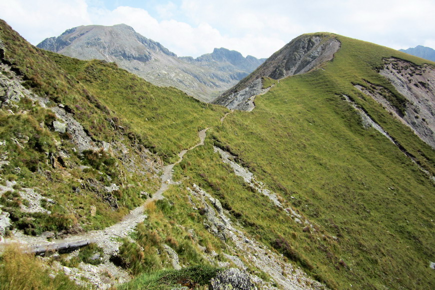
Like a horseshoe, the mountain chain of the Sarentino Alps surrounds the Val Sarentino valley in the heart of South Tyrol – it can be explored on the Horseshoe High Route within seven days.

Really high mountains can only be found in the northern part, an area which nearly resembles a high mountain region. Towards south the mountains of the Sarentino Alps bottom out and form large plateaus, like the Monte Zoccolo in the west, the Villandro Alp in the east and the Renon High Plateau in the south, characterised by the famous Mt. Corno del Renon. The highest mountains are Mt. Corno Bianco (2,705 m a.s.l.), Mt. Corno di Tramin (2,708 m a.s.l.), Mt. Cima di San Cassiano and Mt. Grande Ivigna (both 2,581 m a.s.l.).

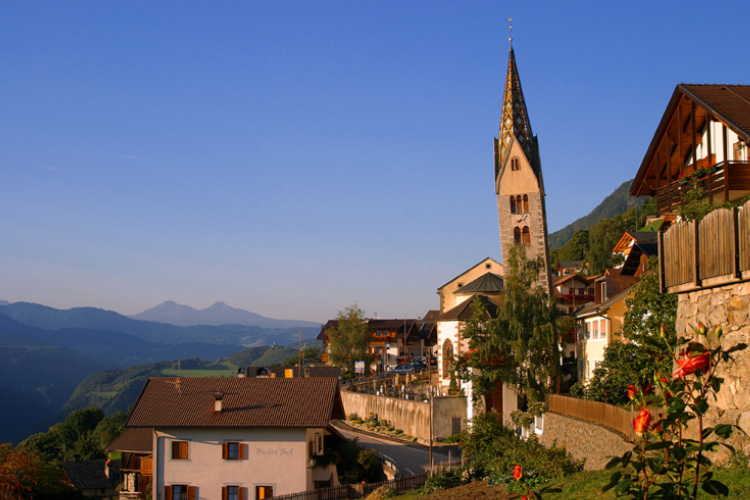
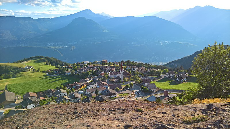
The boundaries of the Sarentino Alps are the Adige and Isarco rivers, the Val Passiria valley near Merano and the Passo Giovo mountain pass. The street leading from Vipiteno to Bolzano via the Passo di Pennes mountain pass, however, devides the Sarentino Alps into an eastern and a western part. Worth mentioning are particularly two highlights: the Earth Pyramids on the Renon as well as the Holy Cross Pilgrimage Church of Lazfons, situated at notable 2,311 m a.s.l. and therefore one of the highest located pilgrimage sites of South Tyrol.

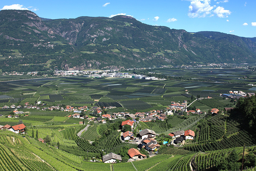
With 40,000 hectares, the Sarentino Alps would be the largest nature park in South Tyrol, which might include the localities of Sarentino, Renon, Avelengo, Verano, Meltina, San Genesio, Racines, Campo di Trens, Fortezza, Varna, Bressanone, Velturno, Chiusa, Villandro and Barbiano. All requirements have already been fulfilled – a protected area has been planned.

Highest peak: Punta Cervina (2,781 m a.s.l.)
Major mountains: Mt. Corno Bianco, Mt. Corno di Tramin, Mt. Corno del Renon, Mt. Cima di San Cassiano, Mt. Pascolo, Mt. Picco Ivigna
Area: South Tyrol (Italy)

Tscherms

How to reach Tscherms

Attractions:
– Castle Lebenberg | Tscherms
– Experience Kränzelhof | Tscherms
– The Kränzel labyrinth | Tscherms

Between the market town of Lana and the spa town of Merano/Meran lies the tranquil village of Cermes/Tscherms, in the heart of the Etschtal Valley in South Tyrol. This rural village extends from the valley floor and its characteristic apple orchards up to the vineyards of the fertile moraine hills below Mount Vigiljoch.
Above the village there towers the local landmark of Lebenberg Castle. Built in the 13th century, this well-preserved castle with a late Gothic chapel is open from April to October, and is a noted hiking destination. Cermes was first mentioned in written records as “Villa Cerones” as early as 857 AD. Today, Cermes is a thriving fruit-growing community boasting a high quality of life and a wide range of leisure activities.
Thanks to the favorable location of this idyllic village, located at the foot of the car-free Vigiljoch hiking area, around Cermes are some of the most beautiful hiking trails and excursion destinations in Merano and Environs, including the 12 km long Marlinger Waalweg irrigation channel trail leading from Cermes to the village of Tel/Töll at the entrance to the Vinschgau Valley. Along this leisurely hike at mid-altitude range, there are wonderful long-distance views over the Merano basin, as far as the Dolomites and the peaks of the Texelgruppe Mountains. Along the hiking trails are many excellent rest stops, taverns and Alpine inns, featuring sunny gardens and panoramic terraces. Quite a few have been awarded the “Real Quality in the Mountains” seal of quality.

The Kränzel labyrinth | Tscherms

How to reach The Kränzel labyrinth

An extraordinary natural piece of art is found in Cermes, a little village near Lana and Merano. A piece of art that is continually growing and changing and from month to month comes in new shapes and forms. This is the labyrinth of the Kränzel winery, a marvellous manor and medieval complex with huge vineyards and fields on an area of 4.5 hectares.

Two hectares of the Kränzel winery are used for the “7 Gardens” – the enchanting Labyrinth Garden, the Garden of Love, the Garden of Ying and Yang, the Garden of Sensuality, the Garden of Confidence, the Theatre and the Fairground. On a regular basis meditation courses are held in this special setting. Furthermore there are a restaurant and a vinotheque.

Opening hours:
From mid-March to early November 2019:
Monday – Sunday from 9.30 – 20:00

Prices:

Adults 8,00 €

f
Contact:

Gampenstraße 1
39010 Tscherms
+39 0473-564549

Avelengo-Verano

How to reach Avelengo and Verano

Attractions:
– Knottnkino | Verano
– St. Kathrein Kirche curch in | Avelengo
– World of orchids | Gargazzone

Rising proud and visible above the Merano spa town is the imposing Ifinger mountain, and at its feet the sunny Tschögglberg mountain plateau and the villages of Avelengo/Hafling, Verano/Vöran and the Merano 2000 skiing area and hiking area. Larch forests, birch trees and meadows define the landscape of the plateau above the spa town. The region is easily reached by car or public transport via a scenic road.

The village of Avelengo has a population of 750 at heights of between 1,250 to 1,600 m a.s.l.. A once-popular summer resort for urban residents, the village of the Haflinger horses is now a year-round holiday destination for families and riding enthusiasts.

High above the Val d’Adige/Etschtal Valley at 1,200 m a.s.l., lies the small village of Verano, with 930 inhabitants. The mild climate invites visitors year round for walks and hikes through the woods and meadows of the mountain plateau. The village is committed to green energy solutions. Also worth seeing in Verano, along with the famous Knottnkino, are the old thatched roofs of the mountain farms.

The Merano 2000 skiing and hiking area is the most popular local recreational zone. From Avelengo and Verano, visitors can reach the valley station of the Falzeben Cable Car in a few minutes. In winter, the child-friendly Merano 2000 family ski area offers, over approximately 40km of trails, ideal conditions for skiers, snowboarders and sled enthusiasts. In summer, Merano 2000 is a hiking area with numerous opportunities for activity and leisure. There are many hiking and mountain biking trails, paragliding courses and the Alpin Bob toboggan ride.