Aurino Floodplain Forest Biotope | Brunico

How to reach Aurino Floodplain Forest Biotope

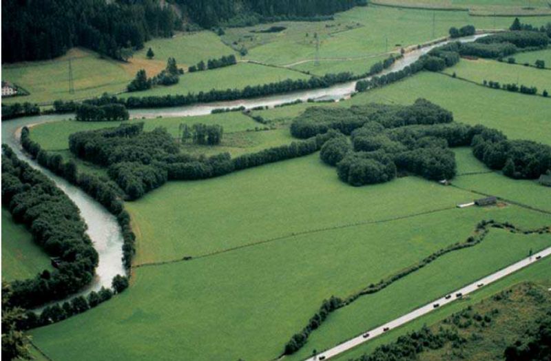
A natural treasure can be found in the Val Pusteria valley, on the left bank of the Aurino river, the most important inflow of the Rienza river. Near the villages of San Giorgio and Stegona, the edge of the Aurino Floodplain Forest lies – “Biotop Ahrauen” in German, “Ontaneti dell’Aurino” in Italian -, a protected area which covers a surface of 60 hectares and includes the municipalities of Brunico, Gais, and Campo Tures. Strictly speaking, it is the area of the lower Aurino River between Molino di Tures and Brunico which has been revitalized since 2003.

This pristine alluvial forest has a long history, dating back to the time of the Austro-Hungarian Empire. Nowadays, the area can be discovered on some hiking trails – one of them is the Aurino theme trail (Ahr Erlebnisweg). The path is suitable for prams until a viewing platform which offers a wonderful view of the surroundings. The Aurino Floodplain Forest is a habitat for many species of butterflies, fish, and birds such as the common kingfisher and the grey heron.

The Aurino Floodplain Forest, formed by glaciers in the last Ice Age, still shows how the primeval forest in this region once looked like. It has been placed under protection as a valuable biotope and a bird sanctuary, furthermore it is part of the European-wide Natura 2000 sites. By the way, the Pusterbike Cycle Path of the Valli di Tures and Aurina valleys leads from Brunico to Campo Tures, following partly the course of the Aurino river.
Vilpiano Waterfall | Vilpiano

How to reach the Waterfall in Vilpiano

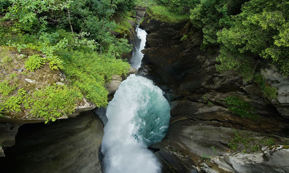
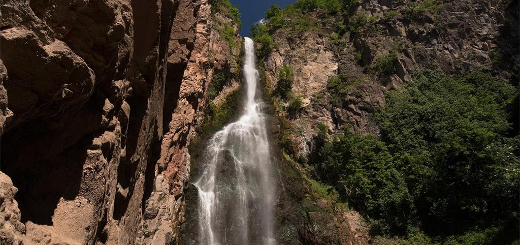
In Vilpiano the Rio Meltina becomes an 85m high waterfall – a natural monument – into the valley, where it then becomes the Vilpiano irrigation channel. This spectacle of nature is accessible all-year-round and excites visitors of all ages. In summer, in particular, a walk through the woods to the waterfall is a delightful, refreshing experience.

The water was also used by a former steam beer brewery. In 1849 the Jewish Schwarz family founded one of the largest breweries in Southern Tyrol. In 1897 a modern power station with a Pelton turbine was added. This was water-powered and generated electricity until the closure of the company in 1986. In recent years the facility was professionally restored and is open to the public. Today, the building houses the national fire academy.

Mineral Springs di San Candido | San Candido

How to reach the Mineral Springs

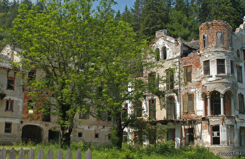
Thermal Baths Although the use of the thermal springs that source here certainly dates back to Medieval times, the traces of the earliest thermal spa establishment only dates back to the 16th century. In 1856, the sanatorium of Dr. Johann Scheiber was built. The sanatorium was transformed into the Grand Hotel Wildbad at the start of the previous century. In 1939 the imposing building was put for auction and abandoned for a long time. Chapel of San Salvatore at the Thermal Springs in Alta Pusteria This Chapel, regularly inhabited by a religious hermit until 1786, was consecrated in 1594. A small sanctuary had already been in place before this date. The altar most probably dates back to the 8th century. The area was probably even an area of worship from a pre-Christian age. Highest point: 1333 m Accessible only by foot, approximately 45 minutes from Innichen / San Candido


df

Contact:
Tourist info San Candido
Piazza del Magistrato 1
39038 San Candido
+39 0474 913149

Lake Dobbiaco | Dobbiaco

How to reach the Lake Dobbiaco

Attractions nearby:
– Fanes-Senes-Braies Nature Park

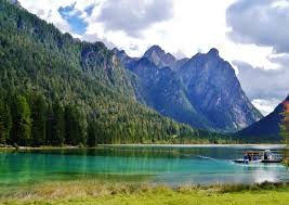
Take a trip by pedal boat or rowing boat, or just a leisurely walk around the lake – either way, Lago di Dobbiaco is a very special destination in every season.

Especially in spring and autumn, Toblacher See with its diverse shore vegetation is an ideal nesting and resting place for waterfowl and migratory birds. You can observe rare species of birds that are only occasionally found in South Tyrol. It is best is from the observation deck, which is located on the western shore of the lake.

In summer, of course, the lake is great for cooling off on hot days: boating or a nature trail, with 11 stations, which provides a wonderful insight into the fauna and flora of this area, and children (and adults) can jump about with wild animals. The nature trail is only 2.5 km long and is accessible for pushchairs. If you prefer a longer hike, that starts right from his hotel near the Lake of Dobbiaco, and even from the center to the lake, it is only an hour’s walk.

And whilst Lago di Dobbiaco in Italy provides unlimited bathing fun in summer, it also offers visitors icy winter magic in the colder season. Skating enthusiasts will be thrilled because when the temperatures drop and the lake freezes, there is the promise of non-stop fun skating and curling. Or: how about a romantic sleigh ride to the lake?

Resia Lake | Resia

How to reach the Resia Lake

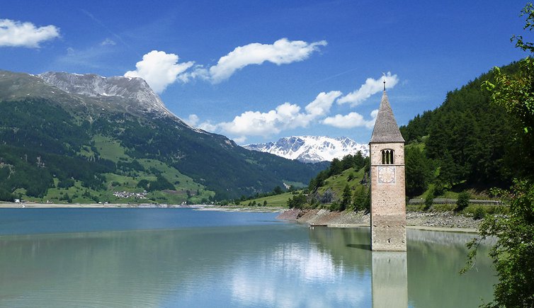
The symbol of Venosta Valley is quite fascinating and rather like a fable. A solitary church steeple emerges half out of the clear waters of the 6 km long Resia Lake, against the majestic background of the wild Langtaufers Valley. However, the story behind this postcard-like image is far less idyllic and the romantic 14th Century church bears testimony to the irresponsible decision of the State to locate a dam there after the end of the Second World War.

As of 1922, Fascism had taken hold in Italy, including South Tyrol. In 1939, the Montecatini conglomerate began the construction of a 22-meter deep dam project in Resia/Reschen, with complete disregard for the sensibilities and remonstrations of the local South Tyrolean population. Construction was suspended after the outbreak of the War and it was hoped that this would mark the end of the project. But in 1947, just two years after the end of the War and much to the dismay of the local population, Montecatini announced that work on the construction of the dam was to be resumed.
By the summer of 1950, it was all over. The locks had been tightened and the water was rising, flooding 677 hectares of land affecting 150 families, half of which were forced to emigrate. Compensation was meager and the inhabitants of the town of Curon/Graun, which was completely flooded, were housed in temporary accommodation – basic shacks located at the entrance of the Vallelunga/Langtaufers. The dam was the product of fascism and through it, hundreds of families lost the basis of their livelihood.

The half-submerged church steeple in the Resia Lake has since been declared a protected historical artifact, becoming a tourist attraction and thus symbolizing the legacy of old Curon.

Lago di Braies | Braies

How to reach Lago di Braies

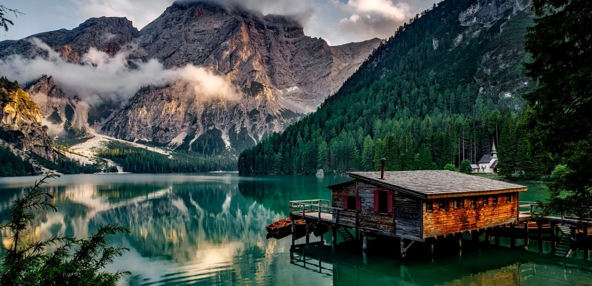
In summer, Lago di Braies lake in South Tyrol reflects colors in all shades from green to blue, in winter Lago di Braies, is covered with ice and snow. In winter and summer, this jewel is the starting point for hikes, ski tours, snowshoe hikes, and walks. Nordic Walkers are also very well catered for.

Origins
According to legend, once upon a time savages dug in the mountains for gold and precious stones. The local herdsmen were jealous and tried to steal the treasures collected by the savages. They were unsuccessful because the savages opened up an underground spring and sunk their treasures in the lake this spring created.

Lago di Braies (Pragser Wildsee) Lake is situated in the middle of Fanes-Senes-Braies (Fannes-Sennes-Prague) Nature Park. Nestled into a wild and romantic rocky valley basin and dominated by the majestic Croda del Becco (Seekofel) Peak, this is the most beautiful lake in the Dolomites. An easy trail encircles the lake; the loop takes about 90 minutes to walk. On the right side, this circuit trail passes a small chapel in the muted shade of spruce, larch, and pine trees. The eastern part of the trail goes over steps. Croda del Becco Peak is beautifully reflected in the lake. Lago di Braies is known as the Pearl of the Dolomite Lakes.

Lake Issinger Weiher | Falzes

How t reach the Lake Issinger Weiher

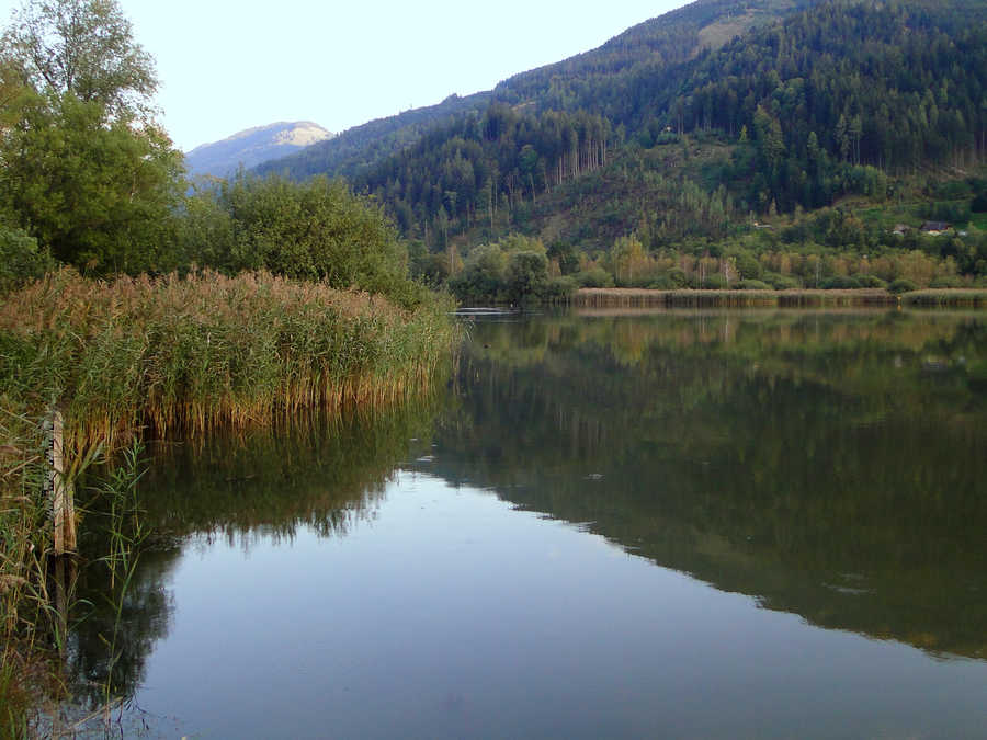
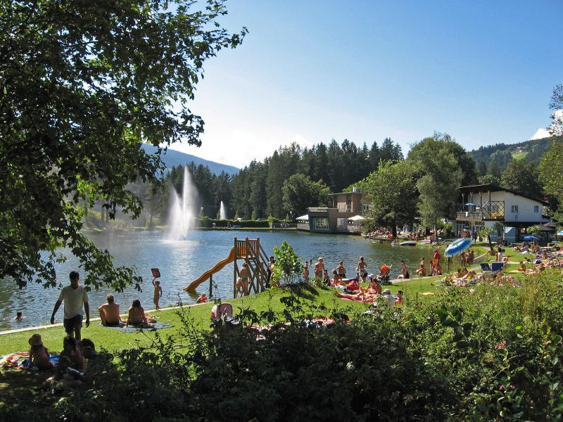
The lake Issinger Weiher – more than just water! The lake Issinger Weiher is one of the last pond biotopes in South Tyrol. Our bathers thoroughly enjoy the intense experience of nature in a still healing atmosphere. To bath, sunbath and relax in such an intact nature, you can consider it as a privilege.

The lake Issinger Weiher is closed on the 20th July and 31st August.

Opening hours:
June 15th – September 8th 2019
Daily from 10 am to 7 pm

Entry fees:

Day card 4 – hours
Adults 7,00 € 3,50 €
Children up to 16 years 5,00 € 3,50 €

Contact:
Weiher Platz 2
I-39030 Falzes/Issing
Tel. +39 0474-565684

Biotope Pirchner Moos | Terento

How to reach the biotope Prichner Moos

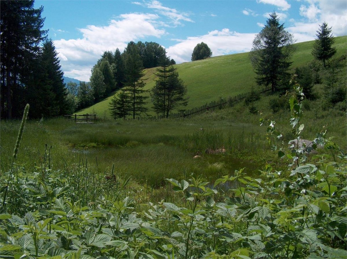
The biotope Pirchner Moos is located at an altitude of 1,300 m and is slightly inclined to the south. The geological base of the biotope is formed by the granite of Bressanone. The biotope shows two different vegetative environments. In the central zone, we find a small low peat bog with margins characterized by the presence of high peat bogs. The small moist biotope is surrounded by moist meadows, sparse woodland, and hedges. In the marshy part, we find different types of moss, including peat moss, but also the blondella, the central leaf, the poa, the sanguisorba, the caryx, and different types of orchids. In the past, wet meadows were used for the production of fodder and litter for horses. The variety of plants in the biotope provides shelter and for many animals. Here we find the wonderful royal dragonflies and, in particular weather conditions, you can also admire the spotted salamanders. The buzzard especially loves the open spaces of the cutting meadow. To the north of the biotope, at the top of the Hohenbichl, runs the “Pusteria line”, the boundary between the south-alpine and eastern rock plates. This tectonic line is one of the most important seismic lines in the Alps.